
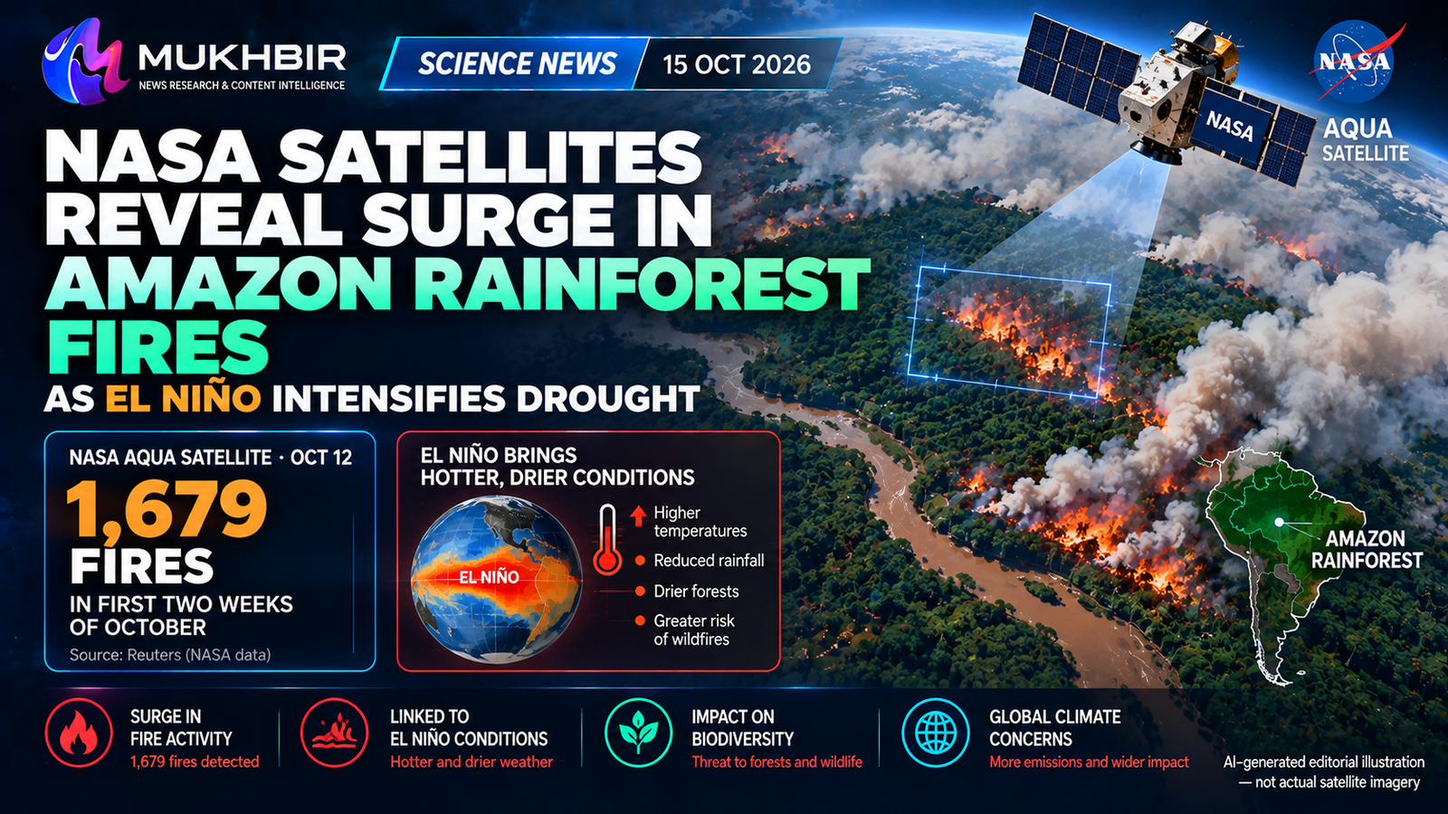
BRASILIA, October 15, 2026 — NASA satellite observations show smoke spreading across parts of Brazil’s Amazon rainforest as worsening drought associated with El Niño contributes to unusually intense fire conditions. In an Earth Observatory report published Thursday, October 15, NASA described an emerging pattern of fires extending across the central and eastern Amazon, including areas near Manaus and Santarém.
The Amazon rainforest fires 2026 have also been documented by Reuters and the Associated Press. Reuters reported on October 14 that Brazil’s Amazonas state recorded 1,679 fire incidents during the first two weeks of October, a rise of 253% from the corresponding period in 2025. That regional incident count comes from the reporting cited by Reuters; it should not be represented as a fire tally calculated from NASA’s October 12 satellite picture.
The fires have caused hazardous air pollution in populated areas and forced authorities to restrict some public activities. Scientists warn that prolonged dry conditions can make vegetation easier to ignite and allow fires to spread, but El Niño is a climate influence rather than an ignition source. Human land clearing and other activities remain significant drivers of fires in the Amazon.
NASA’s October 15 Satellite Report: What Was Observed?
NASA Earth Observatory’s October 15 publication features an image obtained by the Moderate Resolution Imaging Spectroradiometer, or MODIS, aboard the agency’s Aqua satellite on October 12. It shows smoke obscuring sections of the Amazon River and rainforest near Manaus and Santarém.
NASA says satellite monitoring has shown strong rises in fire activity and associated emissions since September. Analysts use systems such as NASA’s Fire Information for Resource Management System (FIRMS), the Global Fire Emissions Database and Worldview to track changes over time.
A satellite image can reveal smoke plumes and thermal patterns across large regions, including difficult-to-access forest. However, one image does not automatically establish how many separate fires occurred, who started them or how much vegetation burned.
The image date, October 12, is distinct from NASA’s October 15 publication date. Keeping the dates separate is essential for accurate reporting.
How Many Fires Have Been Reported in Amazonas?
Reuters reported that Amazonas state registered 1,679 fires over the first 14 days of October 2026, compared with the same period a year earlier. The reported 253% year-on-year rise highlights how sharply the situation deteriorated during a normally wetter part of the season.
The number refers to the state of Amazonas, not the entire Amazon rainforest across all countries. Other Brazilian states have also recorded serious outbreaks, but their figures should not be added without a consistent data source, period and counting method.
A fire incident, a satellite hotspot and an area of forest burned are not necessarily equivalent measures. Satellite sensors may detect thermal anomalies, while agencies can report fire events according to different definitions.
For this reason, Mukhbir uses the Reuters figure as a dated, geographically specific reported number rather than presenting it as the total number of trees or hectares lost.
Why Is El Niño Making Fire Conditions Worse?
El Niño is a recurring climate pattern linked to unusually warm surface waters in the central and eastern tropical Pacific. It changes atmospheric circulation and rainfall patterns in different parts of the world.
NASA explains that the 2026 El Niño has contributed to drought conditions in the Amazon, leaving vegetation and soils more prone to burning. When rain is delayed and temperatures remain high, fires can start more easily and spread farther through dry plant material.
That does not mean El Niño directly lights fires. Agricultural burning, clearing land for farming or grazing, and accidental spread from managed fires remain important human factors in the Amazon.
Climate change can further increase heat and the likelihood of severe drought in some regions, potentially worsening the conditions in which fires occur. Attributing any individual fire to one cause requires investigation.
Scientists Describe a Pan-Tropical Cascade of Fire
NASA Earth system scientist Douglas Morton described a pattern in which El Niño-related dryness and fire first intensify in equatorial Asia before spreading into parts of the central and eastern Amazon later in the year.
Researchers previously documented this sequence following the 2015–2016 El Niño and observed similarities in 2023. Their work suggests that disruptions in tropical rainfall can synchronize fire risk across distant regions.
In 2026, Indonesia has already experienced major smoke and peatland fires, while fires have intensified in Brazil. The connection is climatic: different regions become abnormally dry at different times under a widespread shift in conditions.
The comparison does not establish that every fire in Asia or South America has one shared ignition mechanism, nor does it prove that this year’s losses will equal those of an earlier crisis.
Manaus Faces Dangerous Smoke Pollution
Manaus, the capital of Amazonas state, has experienced deteriorating air quality as smoke reached populated districts. NASA’s report describes fine particulate matter, known as PM2.5, exceeding 135 micrograms per cubic meter on October 12 in a reported city measurement.
Associated Press reporting earlier in October described particularly severe pollution readings and disruption to schools and public activities. Reuters subsequently reported that authorities had canceled classes and events in response to the smoke.
PM2.5 consists of very small particles that can travel deep into the respiratory system. Short-term exposure to wildfire smoke may aggravate breathing problems, especially for children, older adults and people with heart or lung conditions.
Pollution measurements can vary across the city and through the day. A single number should be reported with its date and location rather than treated as a uniform concentration for every resident.
Emergency Responses in Brazil
Reuters said more than 36 municipalities in Amazonas had declared emergencies as conditions worsened. Brazilian authorities were deploying aircraft and fire brigades, while civil-defense teams worked to limit damage and support affected residents.
An emergency declaration is an administrative response to serious conditions; it does not by itself tell readers how many homes or hectares were destroyed in a particular municipality.
Firefighting in remote rainforest areas is difficult because transport is limited, weather conditions are challenging and smoke can interfere with aircraft operations.
The scale and effectiveness of the response will become clearer as authorities publish updated fire statistics, air-quality reports and damage assessments.
What Is Happening Around Santarém?
NASA identified heightened activity across a broad region from forests surrounding Manaus and Santarém toward the mouth of the Amazon River. Santarém sits in the Brazilian state of Pará and is an important transport and commercial center.
Satellite imagery and local reports indicate that the dry conditions affect more than one urban center. Smoke can travel away from the place where a fire actually starts, so poor air quality in a city does not necessarily mean the nearest flames are within its boundaries.
Scientists monitor the region’s emissions and vegetation changes to distinguish active fires from wider smoke transport. Regional observations are especially important because the rainforest extends across numerous jurisdictions and ecosystems.
Why the Amazon Rainforest Matters to Global Climate
The Amazon stores large amounts of carbon in living vegetation and soils. When forests burn, carbon stored in biomass can be released to the atmosphere and damaged ecosystems may lose some ability to absorb future emissions.
The rainforest also helps circulate moisture and support regional rainfall. Extensive forest degradation can alter local conditions and increase vulnerability to later drought and fire.
These effects are important for global climate science, but the current articles do not provide a verified final figure for 2026 fire-related carbon emissions across the entire Amazon. Assigning a precise global temperature increase to this particular episode would be unsupported.
The long-term consequences depend on the area and type of vegetation affected, whether forests recover and how land is managed afterward.
Biodiversity and Wildlife Risks
Amazonian forests support extraordinary numbers of plant and animal species. Many rainforest habitats are not naturally adapted to frequent, intense burning, making repeated fires particularly damaging.
Fire can destroy shelter and food sources, isolate wildlife and disrupt ecosystem processes. Smoke and heat may also affect animals outside the immediate burn perimeter.
Scientists distinguish fires in cleared or agricultural land from those moving into standing forest. Both may be relevant to monitoring, but the ecological consequences can differ.
Reliable estimates of the number of species affected or animals killed require field studies. The available reports do not support a precise total for wildlife losses caused by the current Amazonas fires.
Why Many Amazon Fires Involve Human Activity
Fire is often used to clear vegetation in agricultural and land-development settings. In dry weather, controlled burns can escape their intended area, while deliberate illegal burning can threaten protected land.
Reuters quoted Brazilian officials expressing concern about fires in protected forest areas and indicating that authorities would investigate possible arson or unlawful clearing.
Those concerns should be attributed to officials. A particular fire must not be described as criminally caused unless relevant evidence and investigative findings support the allegation.
Satellite tools can identify where fire activity appears and how it changes, but they cannot determine criminal responsibility from imagery alone.
Can Satellites Help Stop Wildfires?
Earth-observing satellites help agencies detect hotspots, estimate burned areas, monitor smoke and observe how drought affects vegetation. NASA’s FIRMS platform makes near-real-time fire information useful to scientists and emergency planners.
Different satellites provide complementary observations. MODIS has a long historical record, while other instruments can detect smaller or more frequent thermal signals under suitable conditions.
The technology improves situational awareness, but it cannot replace ground crews, aircraft, local knowledge or policy enforcement. Cloud cover, sensor resolution and the timing of passes can also affect what satellites detect.
Combining satellite data with meteorological information and local reports gives a more complete picture than relying on a dramatic image alone.
What Does This Mean for Pakistan and South Asia?
The immediate emergency is in Brazil, and the NASA report does not describe a wildfire incident in Pakistan. Its wider lessons are relevant to countries monitoring drought, air pollution and climate-linked hazards.
Pakistan and other South Asian countries also use satellite weather and environmental information to plan for heat, agriculture, flooding and fire risk. Those are general scientific parallels, not proof of a direct effect from Brazilian smoke on Pakistani air quality.
El Niño can influence weather across multiple regions, but its local effects vary and must be evaluated using regional forecasts and observations.
For students and researchers, the story shows how Earth observation, atmospheric science, ecology and emergency management work together to track a complex environmental event.
What Happens Next?
Scientists and officials will monitor whether rainfall arrives, how many new fire events are detected and whether smoke exposure worsens in populated areas. Longer-term assessments will examine burned area, carbon emissions and the recovery of affected habitats.
NASA’s October 15 report said scientists expect a potentially prolonged and severe season, but this is a forward-looking assessment rather than a confirmed final outcome.
Future articles should cite new measurement dates and distinguish reported fire incidents, hotspots, burned hectares and emissions estimates.
As of October 15, the established development is a documented surge in fire activity, NASA observations of heavy smoke near the Amazon River, serious health impacts in Brazil and scientific concern that El Niño-related drought is increasing wildfire danger.
Frequently Asked Questions
What did NASA report about Amazon rainforest fires in 2026?
NASA published satellite observations on October 15 showing heavy smoke and increased fire activity in the central and eastern Amazon amid drought associated with El Niño.
How many fires were reported in Amazonas?
Reuters reported 1,679 fire incidents in the first two weeks of October, up 253% from the comparable 2025 period.
Did NASA’s satellite count exactly 1,679 fires?
The 1,679 figure was reported by Reuters for Amazonas. NASA’s October 12 satellite image illustrates smoke and fire activity but should not be cited as the sole source of that count.
Is El Niño causing every Amazon wildfire?
No. El Niño contributes to dry conditions, while many fires are started by people or spread from land-clearing activity.
Which cities are affected?
NASA highlighted Manaus and Santarém, while national reporting documented severe smoke-related disruption around Manaus.
Why is smoke dangerous?
Fine particles from wildfire smoke can harm respiratory and cardiovascular health, particularly among vulnerable populations.
Why are Amazon fires important globally?
They threaten biodiversity, release stored carbon, weaken ecosystems and may disrupt regional rainfall and carbon storage.
Does the Amazon fire crisis directly affect Pakistan?
The cited reports do not establish a direct Pakistan-specific impact. The broader issues of drought, air pollution and satellite monitoring are internationally relevant.
About The Author